


Project Overview
The ability to recognize avalanche terrain and make an informed choice about whether that terrain is safe under the current avalanche conditions is a critical component of avalanche risk management. Thanks to recent advances in low-cost remote sensing data and open-source avalanche modelling software, it is possible to accurately map avalanche terrain on a large scale. These maps can provide an objective baseline for understanding avalanche terrain and being able to make informed decisions about avalanche risk management.
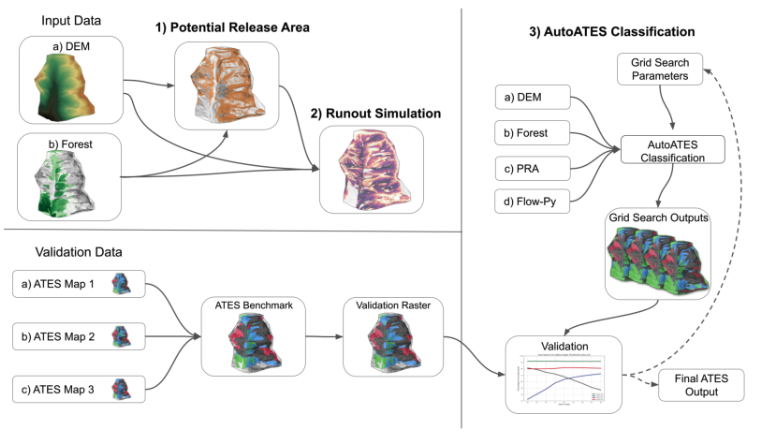
This project aims to both develop research methods for producing accurate and reliable avalanche terrain maps on a large scale and produce a set of digital maps layers capturing avalanche start zones, runout zones, and using the ATES terrain classification system to produce automated ATES maps. The extend of the maps will cover all the public avalanche forecast zones in Western Canada, which total of 400,000 square kilometers.
Involved Researchers
- John Sykes
- Pascal Haegeli
- Grant Statham (Parks Canada)
Partner Organizations
- Avalanche Canada
- Parks Canada
- Austrian Research Centre for Forests, Department of Natural Hazards
Project Funding
Relevant Publications

Characterizing differences among automated avalanche terrain mapping approaches: A multi-institution comparison at Rogers Pass, Canada
autoATES v3.0: Automated ATES mapping at scale across Western Canada
An automated method for regional avalanche alpha-angle characterization based in Western Canada

Automated Avalanche Terrain Exposure Scale (ATES) mapping - Local validation and optimization in Western Canada